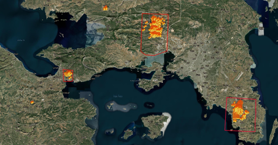
The Emergency Planning and Civil Protection Unit activated the Copernicus/Emergency Management Service – Mapping of the European Union, following the order of the General secretary general of Civil Protection, as a national contact point.
Its aim is the production of a mapping products and data for the regions of Eastern Attica, Western Attica-Boeotia and Corinth (Loutraki), which were affected by forest fires that occurred on Monday, July 17, 2023, to assist the work of the agencies involved in dealing with emergencies and the management of the consequences of the phenomenon.
Για να εμφανίζονται περισσότερα άρθρα της Ναυτεμπορικής στις αναζητήσεις σας εύκολα και γρήγορα, πρέπει να προσθέσετε το site στις προτιμώμενες πηγές σας. Μπορείτε να το κάνετε πηγαίνοντας εδώ.